“No one must look at the rocks of the bridge. People knew that some day it would fall. They must not anger the Spirit Chief by looking at it, their wise men told them.
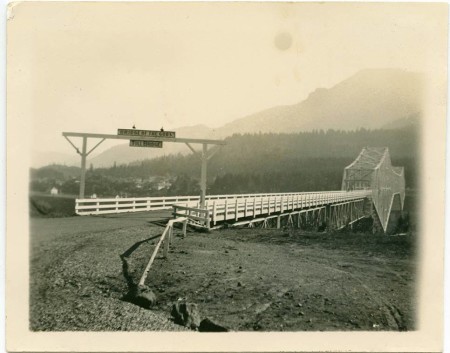
‘Bridge of the Gods’ ca. 1929, photographer unknown.
Read more here
“No one must look at the rocks of the bridge. People knew that some day it would fall. They must not anger the Spirit Chief by looking at it, their wise men told them.
‘Bridge of the Gods’ ca. 1929, photographer unknown.
Read more here
Written by: James D. Keyser, Indian rock art of the Columbia Plateau
Rock art is one of the most common types of archaeological site in Oregon, occurring from the Portland Basin to Hell’s Canyon and the high desert canyons along the Owyhee River to far southwestern Oregon’s Rogue River drainage.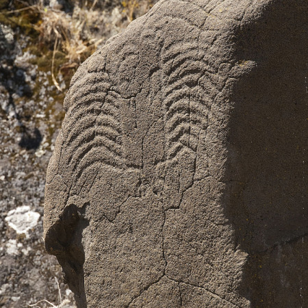 Including both pictographs (paintings) and petroglyphs (carvings), the rock art at these sites was created as early as 7,000 years ago until as recently as the late 1800s. Although petroforms—a third type of rock art composed of outlines cut in desert pavement or boulders laid out in the form of animals or humans—are found elsewhere in North America, none has been discovered in Oregon.
Archaeologists have classified Oregon’s rock art into five traditions, that is, spatially broad-based artistic expressions that were created during a defined period of time. The traditions generally follow Oregon’s aboriginal ethnic/cultural boundaries. Thus, the Columbia Plateau Tradition reflects the art of Sahaptian-speaking tribes such as the Tenino, Nez Perce, Umatilla, and Klamath-Modoc, while the Great Basin Tradition comprises the art of the Numic-speaking bands of the Northern Paiute. In the river valleys of western Oregon, the few sites that are known represent the Columbia Plateau Tradition and a little-known California rock art expression called the Far Western Pit and Groove Tradition, which is the product of Tututni and Kalapuya artists and probably members of other tribes as well.
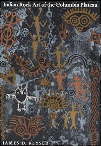
Cover to book text is from.
The subject matter of rock art in the Columbia Plateau Tradition is primarily humans, animals, and geometric designs, one of the most common of which is tally marks—a horizontally oriented series of three to more than thirty short, vertical, evenly spaced, finger-painted lines. Despite its limited subject matter, Columbia Plateau art functioned in several ways, including as a commemoration of the acquisition of spirit power during a vision quest and as a shaman’s ritual expression of power.
Yakima Polychrome designs and the closely related imagery of the Columbia River Conventionalized Style of the Northwest Coast Tradition served in healing and mortuary rituals and were used to witness mythic beings and places. Some images of animals and hunters in the Columbia Plateau Tradition were painted and carved as hunting magic. In the Klamath Basin, art in the Columbia Plateau Tradition has several stylistic expressions, but current research suggests that all of them were the exclusive purview of shamans.
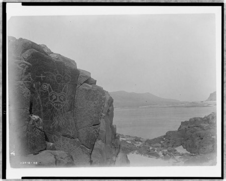
Columbia River Gorge
Far Western Pit and Groove Tradition rock art is found from the southern Willamette Valley near Eugene into the Umpqua and Rogue River drainages, where it occurs as cupules—shallow dimples—and simple geometric forms pecked and ground into streamside boulders. Known as Baby Rocks or Rain Rocks, ethnographic sources indicate that these simple petroglyphs were carved both by shamans accessing and using supernatural power to call the salmon and communicate with the gods and by women who wanted to bear a child.
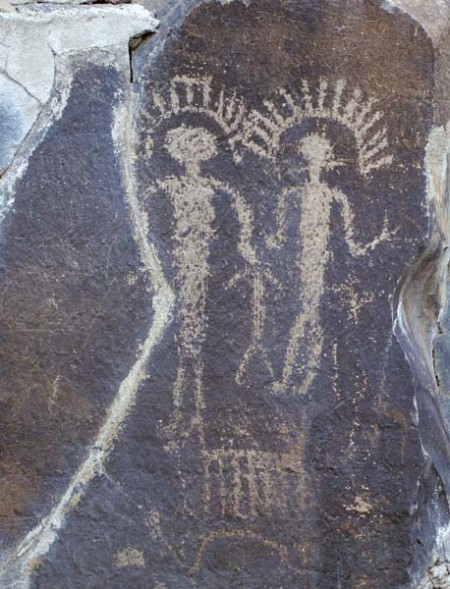
Vantage, WA.
Certainly much Great Basin rock art was made by shamans who were acquiring or using supernatural power, and much of the geometric imagery may have been generated in the artists’ minds by stimuli experienced during a trance. Other Great Basin imagery, however, is likely to have been made in conjunction with subsistence activities during the seasonal round of these high-desert hunter-gatherers and likely had a broader function as part of the rituals associated with subsistence.
This photo really sums up in an image what this project is about to me. I can imagine what it would feel like to be Great Grandmother, watching the old ways die underneath the feet of something new. The very landscape has been rearranged and so has our Story. This photo is of the Cascades and Cascade Locks, Oregon prior to bonneville dams construction in the early 30′s.

A photo taken just before the Cascades were silenced. 193?, photo author unknown.
Read more about Bonneville Dam’s impact on my ancestors here
“…. They didn’t sign away their rainy Eden or sell it, die in warfare, or move to reservations, not until twenty-five years after the catastrophes that swept most of them away. It wasn’t smallpox that laid them low. Suddenly most of them were simply gone. The Wapato Lowlands in particular were empty and silent. Did
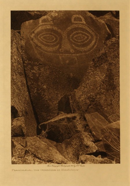 God call them home? The few survivors walked away dazed. Took to speaking other languages. Were replaced by strangers. After a few decades hardly anyone remembered that they had ever been there.”
Read more of “She Who Watches — Tsagaglalal By Rick Rubin” here: http://www.ochcom.org/chinook/
Listen to the story, ‘She Who Watches — Tsagaglalal’, as told by Ed Edmo:
An Edward S. Curtis photo from 1909 of my Ancestors old village site near Skamania, Washington. Lewis and Clark called us the ‘Shahala Nation’, when they came
 through the Gorge in 1805. We lived in three subdivisions: the Yhehuhs, who were above The Cascades of the Columbia River, the Chahclellahs, who lived below The Cascades, and the Wahclellahs, who lived near Beacon Rock. We had six villages on both sides of the river until the 1830′s, when what was called the ‘Cole Sic and Warm Sic’ (Malaria) epidemic came through and decimated our numbers to near extinction. Some number perspectives: in 1780, we numbered 3,200, in 1805, Lewis & Clark’s count was 2,800, 1,400 in 1812, and about roughly 80-100 after the epidemic of the 1830′s. The survivors then created the single village that became the Wat-la-la.
My heart lives here, amongst the rivers and restless winds. The hills and snowy peaks, wild flower and ancient tree. My bones rest here, in stone, and mud, and stories yet told.
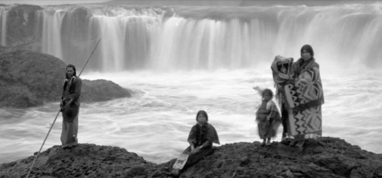
Family at Celilo, 189?
“My generation is now the door to memory. That is why I am remembering.” Joy Harjo
Many of us River People speak about still hearing those waters fall. Like a longing at the doors of our dreams. Or a remembering that we know in the beating of our hearts. Each pump a drum of longing to be home, amongst the joyful jumping of Salmon. A familiar smoke drifting from shacks holding old stories. The repeating patterns of metaphor, and the sound of Echoes of Water Against Rocks.
Watch the documentary, Echoes of Water Against Rocks, here:
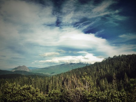
Mt. Shasta | ©2014 H a v e n
Thirty years later, he told his story to John C. Root who proceeded to gather an exploration team in Stockton, California. 80 people joined the team, but on the day the team was to set out, Brown did not show up. Brown was not heard from again.
Long ago, when the world was young, all people were happy, The Great Spirit, whose home is in the sun, gave them all they needed. No one was Hungry, no one
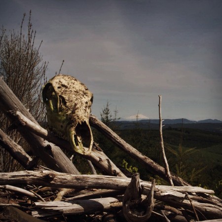
‘Keeper of Fire’ | © 2015 H a v e n
The Great Spirit took the two brothers to the top of the high mountains and wakened them. They saw that the new country was rich and beautiful.
“Each of you will shoot a arrow in opposite directions,” he said to them. “Then you will follow your arrow. Where your arrow falls, that will be your country. There you will become a great chief. The river will separate your lands.”
One brother shot his arrow south into the valley of the Willamette River. He became the father and the high chief of the Multnomah people. The other brother shot his arrow north into the Klickitat country. He became the father and high chief of the Klickitat people.
Then the Great Spirit built a bridge over the big river. To each brother he said, “I have built a bridge over the river, so that you and your people may visit those on the other side. It will be a sign of peace between you. As long as you and your people are good and are friendly with each other, this bridge of the Tahmahnawis will remain.
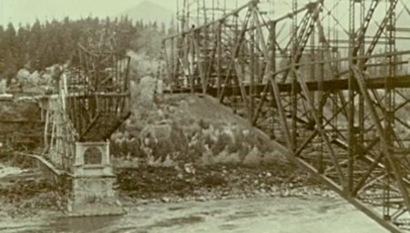
Building of the the modern day Bridge of the Gods, ca. 1925
Then they began to be sorry for what they had done, and they begged the Great Spirit for fire. “Give us fire, or we will die from the cold,” they prayed. The heart of the Great Spirit was softened by their prayer. He went to an old woman who had kept herself from the wrongdoing of her people and so still had some fire in their lodge.
“If you will share your fire, I will Grant you anything you wish,” the Great Spirit promised her. “What do you want most?”
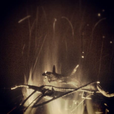
“Eternal” | ©2015 H a v e n
“You shall be young and beautiful tomorrow morning,” promised the Great Spirit. “Take your fire to the bridge, so that the people on both sides of the river can get it easily. Keep it burning there always as a reminder of the goodness and kindness of the Great Spirit.”
The old woman, whose name was Loo-wit, did as he said. Then the Great Spirit commanded the sun to shine again. When it rose the next morning, it was surprised to see a young and beautiful maiden sitting beside a fire on the Bridge of the Gods. The people, too, saw the fire, and soon their lodges were warm again. For many moons all was peaceful on both sides of the great river and the bridge.
The young men also saw the fire–and the beautiful young woman who attended it. They visited her often. Loo-wit’s heart was stirred by two of them–a handsome young chief from south of the river, whose name was Wyeast, and a handsome young chief from north of the river, whose name was Klickitat. She could not decide which of the two she liked better.
Wyeast and Klickitat grew jealous of each other and soon began to quarrel. They became so angry that they fought. Their people also took up the quarrel, so that there was much fighting on both sides of the river. Many warriors were killed.
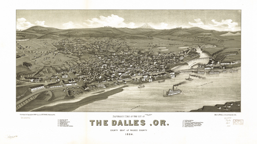
The Dalles, Oregon. ca. 1884
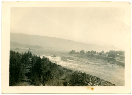
Pre-dammed Cascades. 1912(?) author unknown.
——-Clark,Ella (1953) Indians of the Pacific Northwest (renewed 1981). The Regents of the University of California
Warring gods, black snow and deities represented by mountains are central
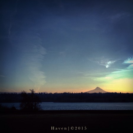
Wy’east | © 2015 H a v e n
To the Yakama, Klickitat, Cowlitz, Multnomah, Puyallup, Nisqually and other Native Americans of the Pacific Northwest, peaks like Mt. St. Helens embodied supernatural and spiritual forces…”
“…. They didn’t sign away their rainy Eden or sell it, die in warfare, or move
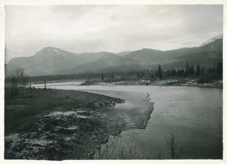
Columbia River Gorge – view of Robin’s Island, Hamilton Mt. (left), Aldrich Butte (center), Table Mountain (right). (source: Oregon State Archives)
Read more of “She Who Watches — Tsagaglalal By Rick Rubin” here