Matriarch of the Cascades

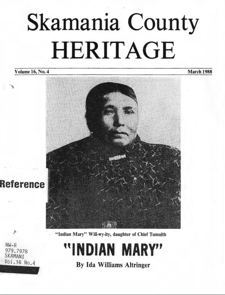
“Mary was born at the Cascades in 1854, in the “Moon of the Falling Leaves”, October. Many Indians did not know what year they were born, much less the month and day.

Grandmother.

Matriarch.

Mary’s mother was Susan, a member of the Wishram tribe. Her father was Tomalth. * (Amanda pronounced it “Tum’uth”.) He was the 6’4″, red-haired chief of the Cascade tribe of Chinook Indians.He was the son of Chief Stilgat of one of the tribes at the mouth of the Columbia River.

Mary was only eighteen months old at the time of the Battle of the Cascades, in March 1856. After her father was hanged by order of the U. S. Army, Mary went with her mother and other family members back to the Wishram village.

In the 1870′s, as the young widow of Henry Will-wy-ity, a Wishram Indian, she traded a team of horses to Kenzy Marr for 160 acres of his donation land claim at Marr’s Landing. Here, at the end of the present lndian Mary Road, her brother built for her a nice wooden cabin.”

Read more about our Grandmother, Kaliah Will-wy-ity, here at my Cousins webiste: https://chieftumulthtreatysigner.files.wordpress.com/2016/03/skamania-historical-society-pamphlet-on-indian-mary-written-by-ida-williams-altringer.pdf

Also, check out this site for more info pertaining to our heritage as Watɬlala Band of Chinuk (Cascade Indians): https://chieftumulthtreatysigner.wordpress.com/

Old photo shows "Indian Mary" Stooquin, right, with daughters and a friend. From left is Nellie Arquette Miller, 18, a friend; Amanda Williams, 14; Abbie Reynolds Estrabrook, 7; and Mary Will-wyity, 40. Photo taken at Moffett's Hot Spring about 1894.

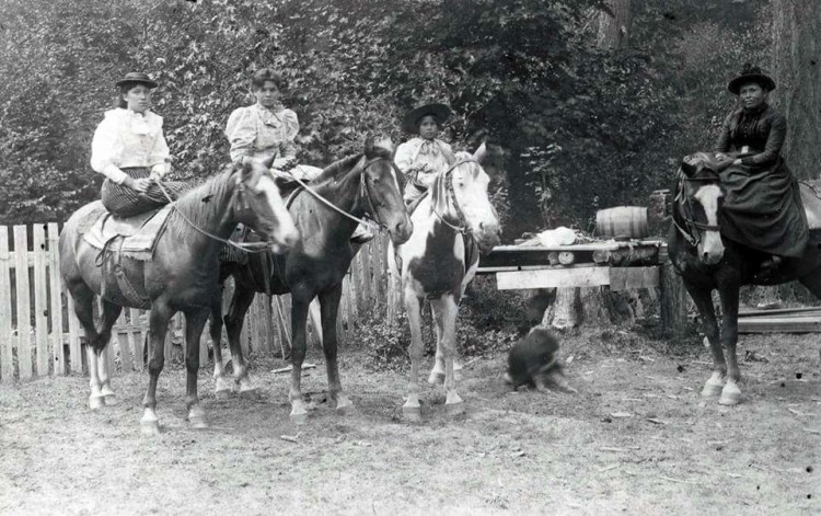
Old photo shows “Indian Mary” Stooquin, right, with daughters and a friend. From left is Nellie Arquette Miller, 18, a friend; Amanda Williams, 14; Abbie Reynolds Estrabrook, 7; and Mary Will-wyity, 40. Photo taken at Moffett’s Hot Spring about 1894.

Remembering to Be Human Beings: Three Years After Standing Rock

Many felt that a dream had led them to Standing Rock in 2016, myself included. Many spoke of how it felt like their Ancestors had nudged them awake, as if the Earth was rising in a chorus of resistance.

Turtle Island, November 2016.  | Photo: Si Matta (H a v e n)

Turtle Island, November 2016. | Photo: Si Matta (H a v e n)

Time stood still in the liminal spaces of the day to day of camp life… and the ritual of living was a Sacred space.. one worth defending.

I was at Standing Rock, because I felt I needed to gather and bear witness to what was happening there as relatives put their lives on the line to defend the Sacred. I was there to bear witness to prophecy and resilience, and the meaning of dreams and place. I was there for my own Ancestors, and the future generations. There was a collective joy and togetherness in camp, that many of us felt ripple through our hearts, melting intergenerational traumas to the ground. We all felt that fire in our hearts!

I share this video I made, to show more of that feeling of what it meant to be there. I have tons of riot footage, and footage of anger and despair, but I wanted to show that, even though they tried to break our Spirits, we were remembering what it meant to be human.

To all the Water Protectors the world over,

Masie!

Mni Wiconi!

A Portal to the Gods

This is no ordinary Bridge! This is a Bridge that spans more than just 706 ft, it spans time itself. This spot, a vortex of memory, a portal to the Gods, a gateway to the mountains of fire.

Bridge of the Gods, 1926 & 2012.

Bridge of the Gods, 1926 & 1912.

As a child, I always thought it was funny that we would bridge the Gods via, a car. But as I got older, and I walked the span alone, the wind would rise and flap like a Thunderbird all around me, and I knew then why the Gods called this Home. I would look down, 140 ft below me, and see the old Cascade Rapids straining against the stagnant waters of the 21st century, as the Ancients laid in silent wait below. I knew why I called this Home, where water is blood, and Gods do roam.

Read the “Bridge of the Gods Legend” here: http://www.gatheringthestories.org/2013/10/20/bridge-of-the-gods/

Shell Rock and the Breaking of Taboo

From the Oregon State Archives “A 1940 Journey Across Oregon”:

“… SHELL ROCK MOUNTAIN, 136.9 m. (2,068 alt.), is opposite WIND MOUNTAIN, which is in Washington. The Indians believed that the Great Spirit set the whirlwinds blowing in constant fury about Wind Mountain as a punishment to those who, breaking the taboo, had taught the white men how to snare salmon. …”

My auntie, Virginia Miller's canoe in the shadow of Wind Mountain. Edwards S. Curtis photo.

My auntie, Virginia Miller’s canoe in the shadow of Wind Mountain. Edwards S. Curtis photo.

Landscape of Visions

This is a photo of my hometown of Carson, Washington taken in the year 1925. The domed mountain in the right hand side is Wind Mountain. 10473063_1117725894905723_815477723240662057_o
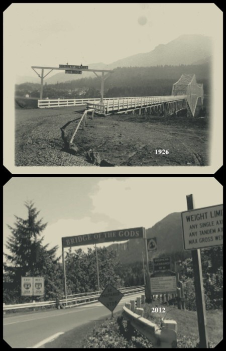
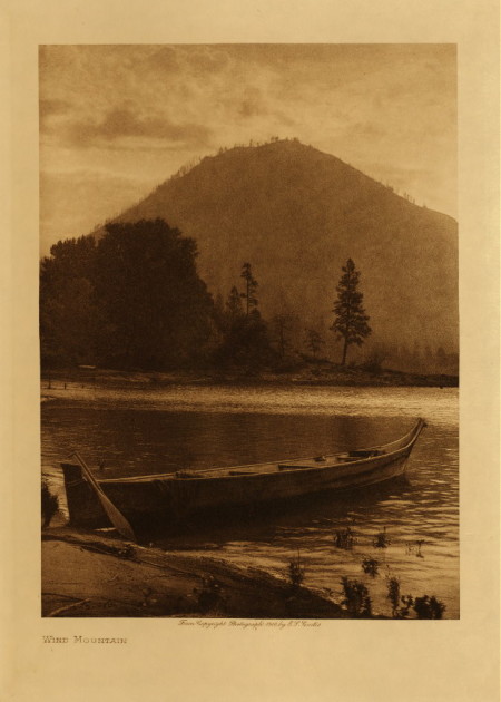
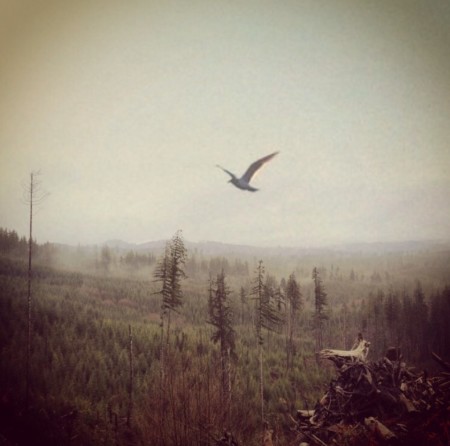
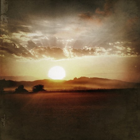
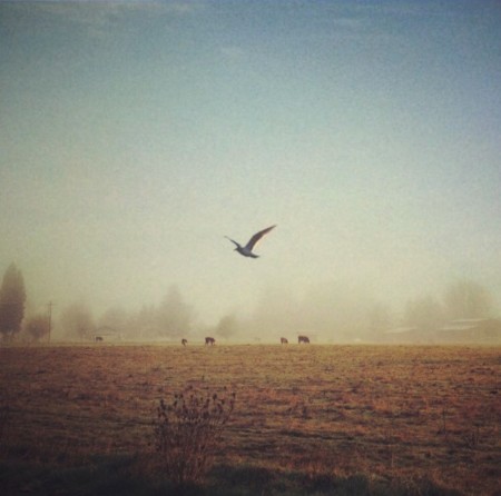
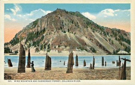
Growing up, I could see Wind Mountain directly from my bedroom window. I would get lost in daydream, which is a pretty common occurrence for me, and wonder how my ancestors revered and interacted with this landscape. What was it about this mountain that made it holy or sacred? Was it because of it’s stand alone features in the middle of the Cascade Mountain range? Was is it because of the sacred mineral waters that bubbled and boiled in her shadows? Or, was it because it could have been where the actual land bridge, known as the Bridge of the Gods, could have crossed the mighty river? – And Who had the first Vision on her lofty peak? Was it Coyote?

Leaves Gather Their Breath

Leaves Gather Their Breath

The wind stands still
just for a moment
as the leaves
gather their
breath
before
the
long
descent
to
fertile grounds.

Immersed in cyclic
compost seeping
with mist.

the heat
of
Rebirth.

Leaves Gathering Their Breath | © H a v e n

Leaves Gathering Their Breath | © H a v e n

Mornings

The Stellar Jays raise up their chorus through the mists, beckoning the sun in the breaks of rain. Ravens rise with the Eagles as I sip my tea from the edge of the world, longing to dance. The slow hum of the wind winding up the canyons and valleys, washing the fresh rain upon the thirsty ground.

© H a v e n

© H a v e n

Where I come from, this is called church.

The Maker of Rain

The Maker of Rain

The maker of rain sits in front of a forgotten sun
spilling forth its solemn tears it cries-
the rhythm of it’s sorrows sings sad songs
lamenting the long day in sheets of gray hues.
the echoes of thunderous choirs
and winds that chant through forests halls-
in these shadows-
the maker of rain summons.

Maker of Rain | © H a v e n

Maker of Rain | © H a v e n

Submerged Forest

Up until the completion of Bonneville Dam in 1938, a ghostly white forest of drowned tree stumps could be observed along both sides of the Columbia River between Cascade Locks and The Dalles. The submerged forest was first mentioned in a geologic textbook in 1853, in “Principles of Geology” by Sir Charles Lyell

“Thus Captains Clark and Lewis found, about the year 1807 (sic), a forest of pines standing erect under water in the body of the Columbia RIver, which they supposed, from the appearance of the trees, to have been submerged only about twenty years.”

Both Lewis and Clark in 1805 and Captain Fremont in 1845 recognized that the trees were drowned by the formation of a lake behind a 200-foot landslide dam.

Penny Postcard, ca.1920s, "Wind Mountain and Submerged Forest, Columbia River".

Penny Postcard, ca.1920s, “Wind Mountain and Submerged Forest, Columbia River”.

Possibly triggered by an earthquake, the dam material slid down from the cliffs of Table Mountain and Greenleaf Peak at a time later determined to be between 1260 and 1290 A.D. The stumps were described in detail by Minnesota biologists Donald B. and Elizabeth G. Lawrence in a series of definitive papers in 1935, 1937, 1937, and 1958. The Lawrences were the first to date the time of the landslide, by caron 14 analyses, as having occurred 700 years before. As of 1936, the Lawrence’s counted 3,068 stumps on the south side of the river, and 938 on the north side of the river. The maximum concentration of stumps on the south side occurs just above the mouth of Viento Creek, where more than 800 stumps were counted within a small area.

Source: John Allen, Professor of Geology at Portland State University, 1985, “Time Travel in Oregon”.